Glen Pass along the Rae Lakes Loop.
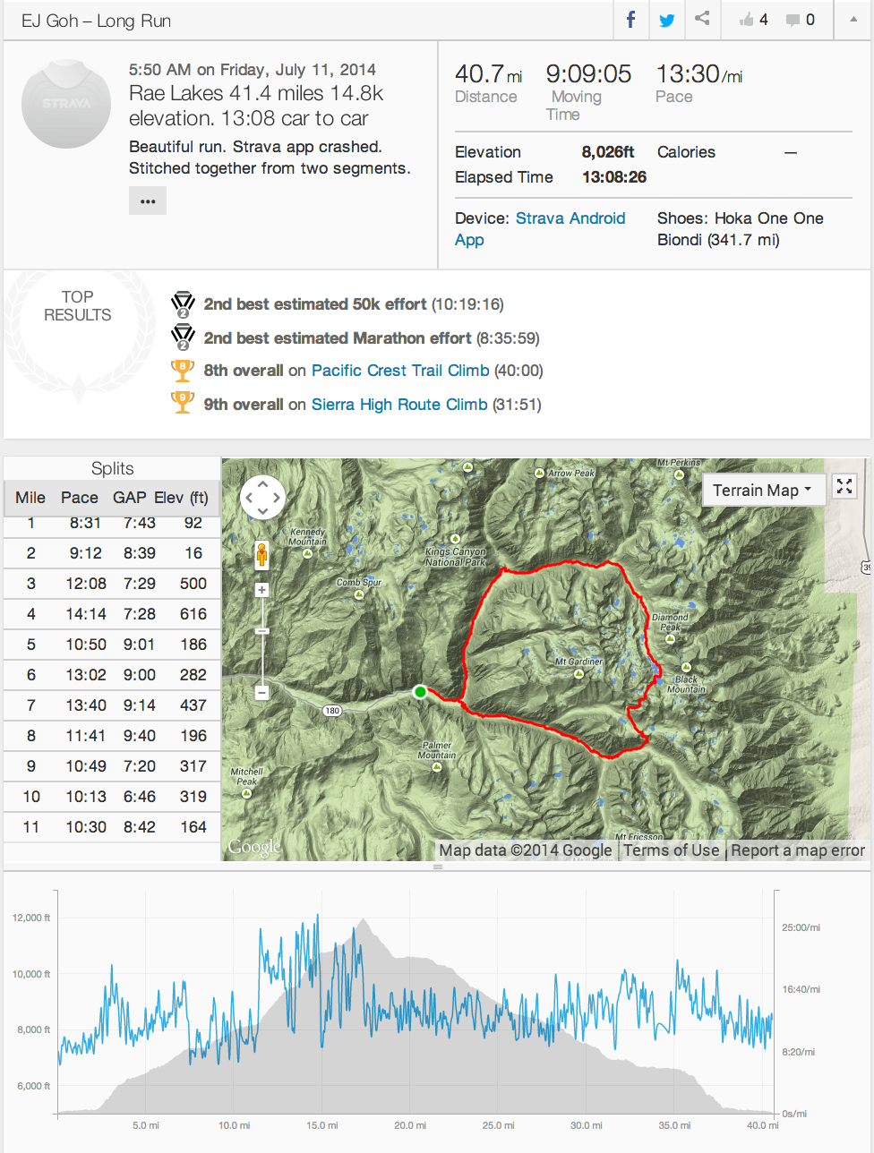
I ran the Rae Lakes Loop 41.4 miles 14,800k elevation change in King’s Canyon National Park in 13:08 hrs car to car.
I ran my first long trail, the Grand Canyon Rim to Rim to Rim (R2R2R), about 2 months prior to this run. In the process, I discovered the fun of covering significant ground in half a day through beautiful terrain solo and I set my sights on running the Rae Lakes loop in the High Sierra.
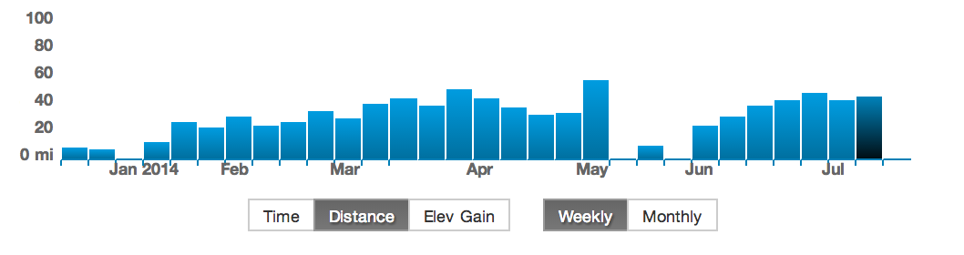
I took 3 weeks off running after the Grand Canyon because of travel/illness and I had to rebuild my running base in 6 weeks due to pending family commitments. This time was a bit short and I hoped to capitalize on my previous training.
Training log from Strava. The spike in May was the R2R2R and the last bar on the right was the Rae Lakes run. I didn’t manage to get all the elevation change training I wanted before the run. I did two 20 mile training runs in the two weekends before Rae Lakes.
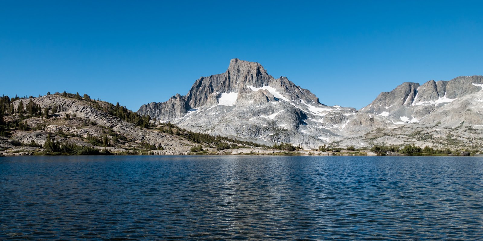
About half the Rae Lakes loop is above 8k ft in altitude, so part of the training plan was to spend time acclimatizing for this run compared to the Grand Canyon where virtually the entire run was below 8k ft. I took advantage of the July 4th long weekend to visit Mammoth Lakes where I acclimatized with a 19 mile run to 1000 Island lake on the PCT/JMT.
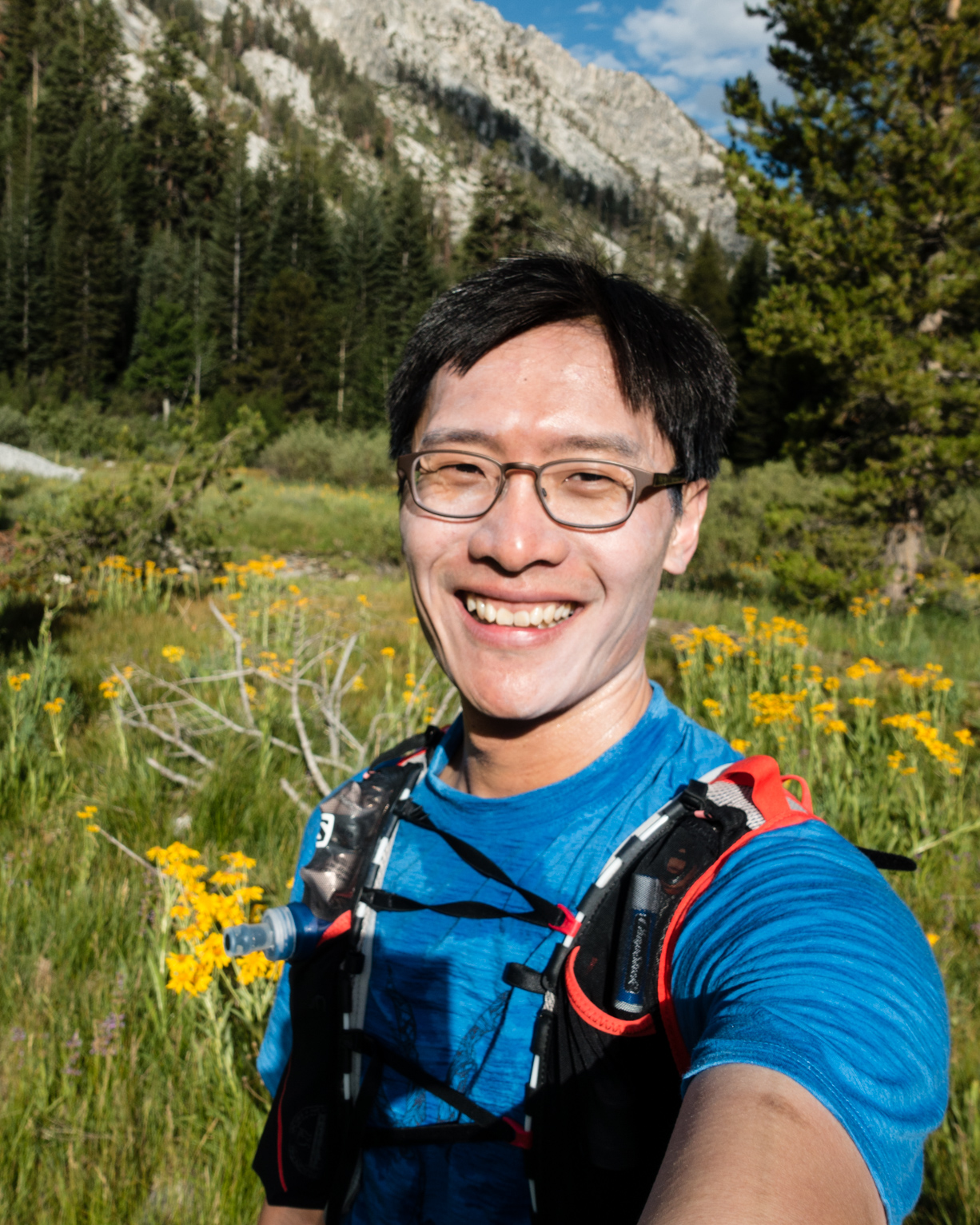
Banner Peak over 1000 Island Lake on my acclimatization run.
That acclimatization run unfortunately felt pretty horrible and I briefly considered bailing on the Rae Lakes run because I wasn’t sure I could finish well before sunset. Alternatively, I just budgeted food/gear for 14-16 hours rather 12-14 hours (I ended up with too much food) and steeled myself for some suffering in the dark.
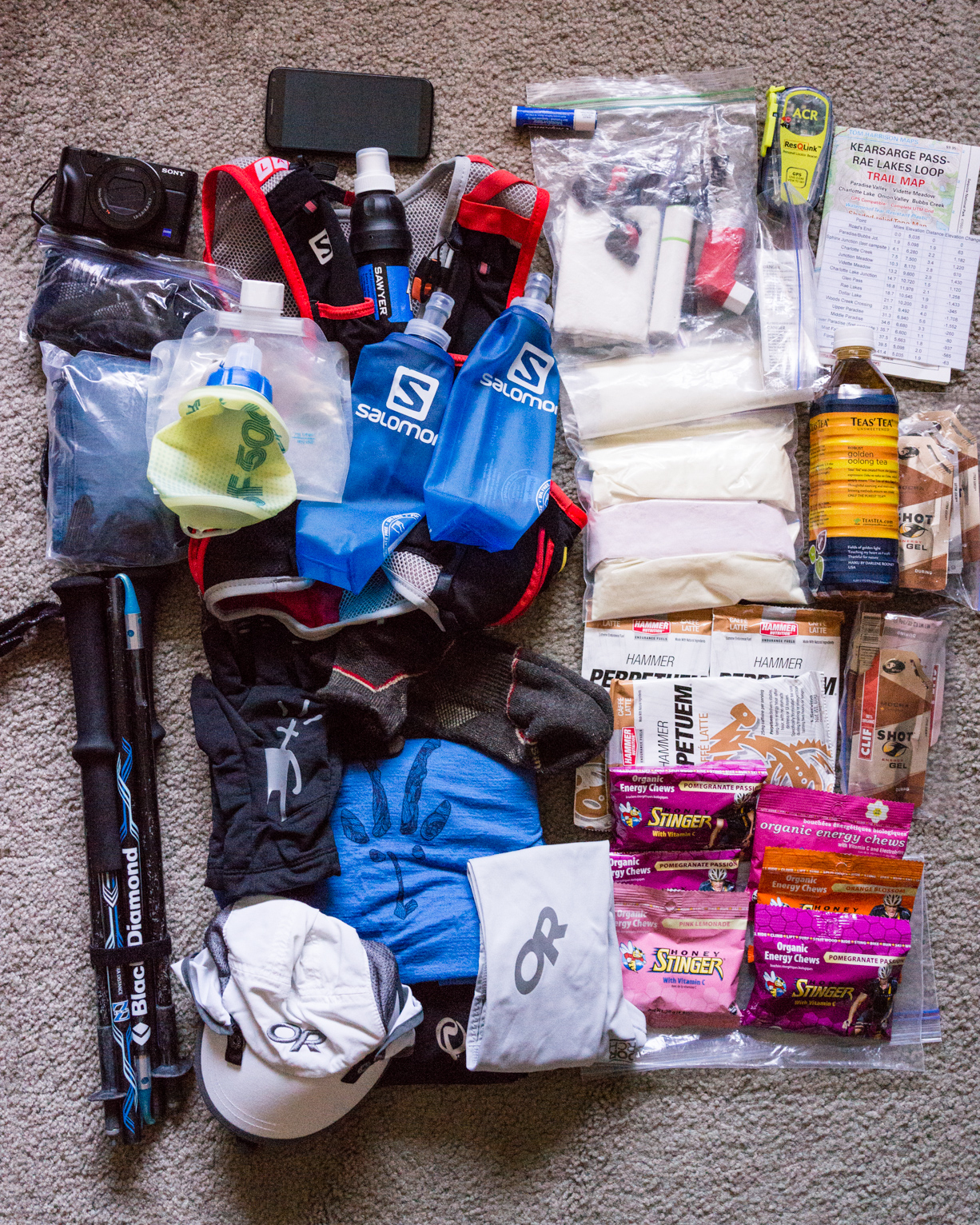
My Rae Lakes gear on the left. Pretty much the same gear I brought for the Grand Canyon. I brought a lot less energy gummies than the Grand Canyon, bringing more energy drink powders. Cory recommended Hammer Perpetuem powders that I tested in Mammoth Lakes and liked. I also brought a very small (3 oz) gravity water filter because I didn’t want to risk getting giardia. |
I drove up to King’s Canyon on Thursday and stayed in a lovely former apple farm about 1:15 hrs to trail head (Thanks Judy!). Weather forecasts showed that it wasn’t going to be as hot as the R2R2R so I planned on starting at 6 am to enjoy the entire run in daylight.
Friday 3:30 am. I ate yogurt and a banana, started driving by 4 and reached the trailhead at 525.
While putting on sunscreen at the parking lot, I met a couple that were going to also run the same trail. I briefly inquired about their plans to see if I could pace them partway for some company --- I had a lot of fun running with Sydney whom I met on the trail in the Grand Canyon --- but they weren’t forthcoming about their plans so I headed out before they were ready. I didn’t see them again for the rest of the day but their car was still there when I got back to the parking lot later that day.
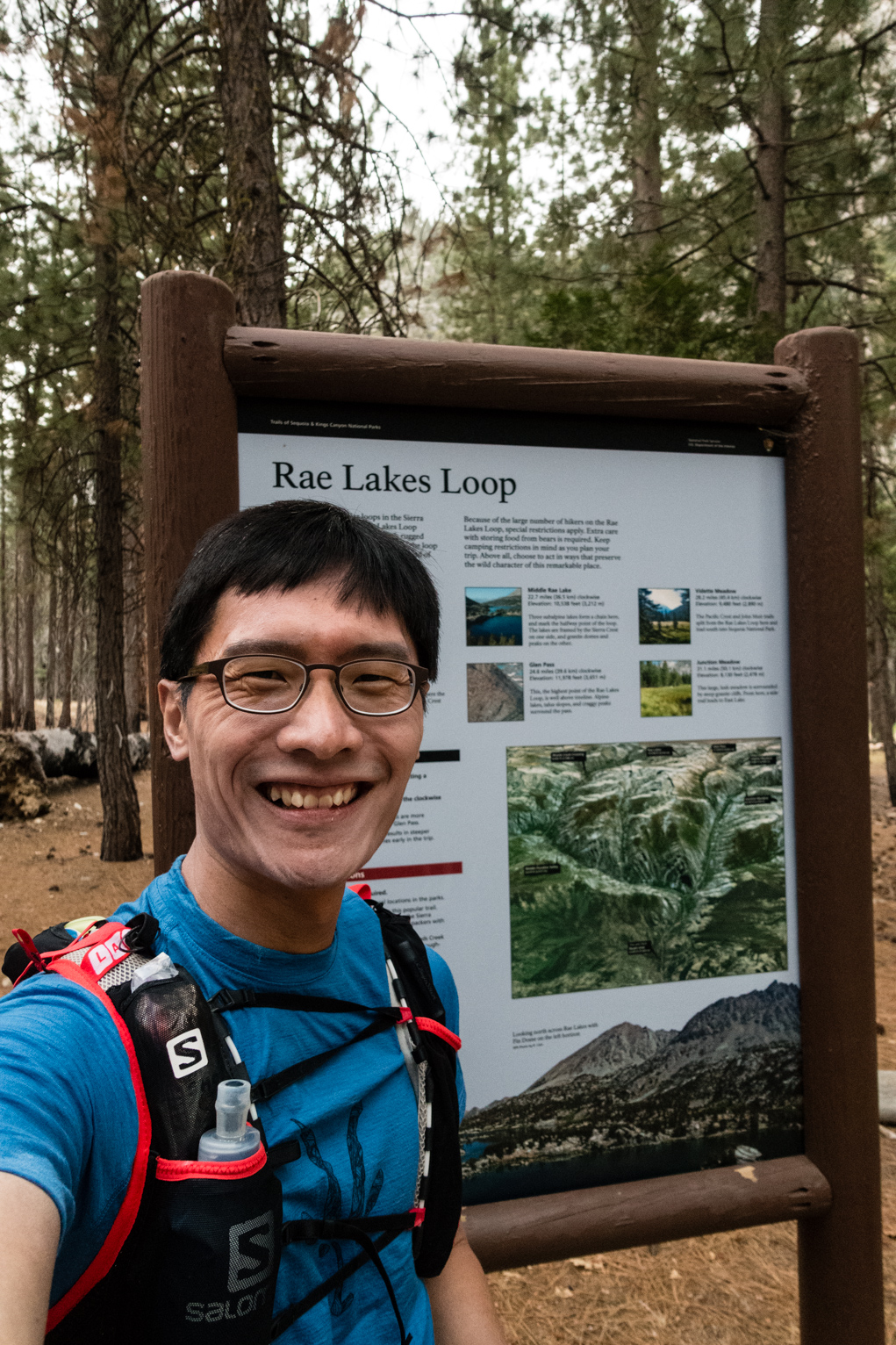
At 5:50 am, I stood next to the Rae Lakes trail head sign board.
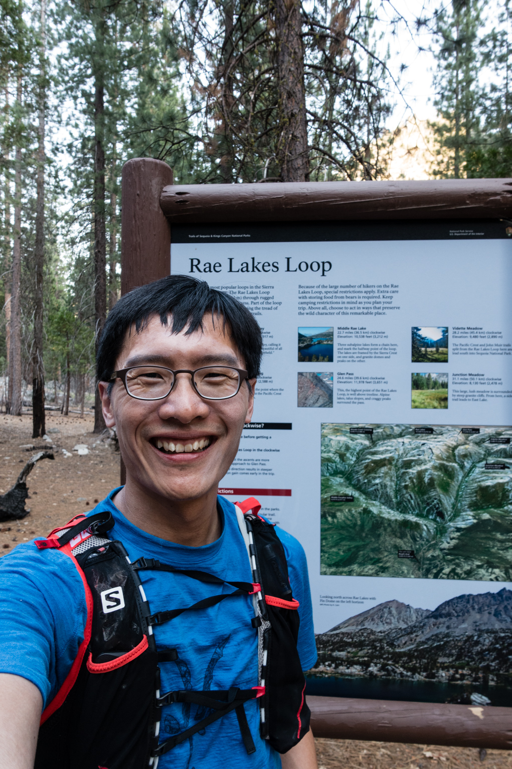
Before and after, a little sweatier but remarkably similar!
The trail started off flat and sandy for the two miles to the first junction leading to Bubb’s Creek. Counter-clockwise was the recommended direction for running this loop because you get to the high point of the loop at around mile 17. I constantly referred to a printed sheet with distances and elevation changes between trail junctions (spreadsheet here) that was taped over to waterproof it --- a trick learnt from preparing climbing topos for longer multi-pitch routes.
The trail along Bubb’s Creek was a little overgrown and I slowed down in the twisty overgrown sections of trail for fear of suddenly encountering a snake (I regular saw snakes mentioned in the trip reports I read before the run).
8 miles into the run at my first water stop. I was already sweating profusely and contrary to the weather forecast, it was pretty hot and humid. Soon after my first water stop, the trail started climbing and I began to get good views of the mountains around me. I also noticed the limits of my mediocre acclimatization schedule as I got higher --- I found it difficult to run uphill and for long continuous stretches above 9k ft. The previous weekend training in Mammoth likely made a difference since I was feeling winded well below that altitude in my training run there. I’d learnt my lesson about carrying too much water between refill stops in the Grand Canyon and this time I carried much less water between refills and also brought more drink mixes over solid food because I find it easier to drink than eat at higher altitudes. |
Unfortunately, filtering water and mixing drinks consumed more time than I expected --- I had 4 water stops that took up 1.5 hrs in total. I didn’t use purification tablets because drink mixes interact poorly with purification and I wanted to drink a liter immediately at every stop.
East Vidette a few miles after joining the PCT trail. Up up up.
On the way to Glen Pass, the high point of the loop, I enjoyed views of Charlotte Dome, which is on the list of 50 classic climbs of America.
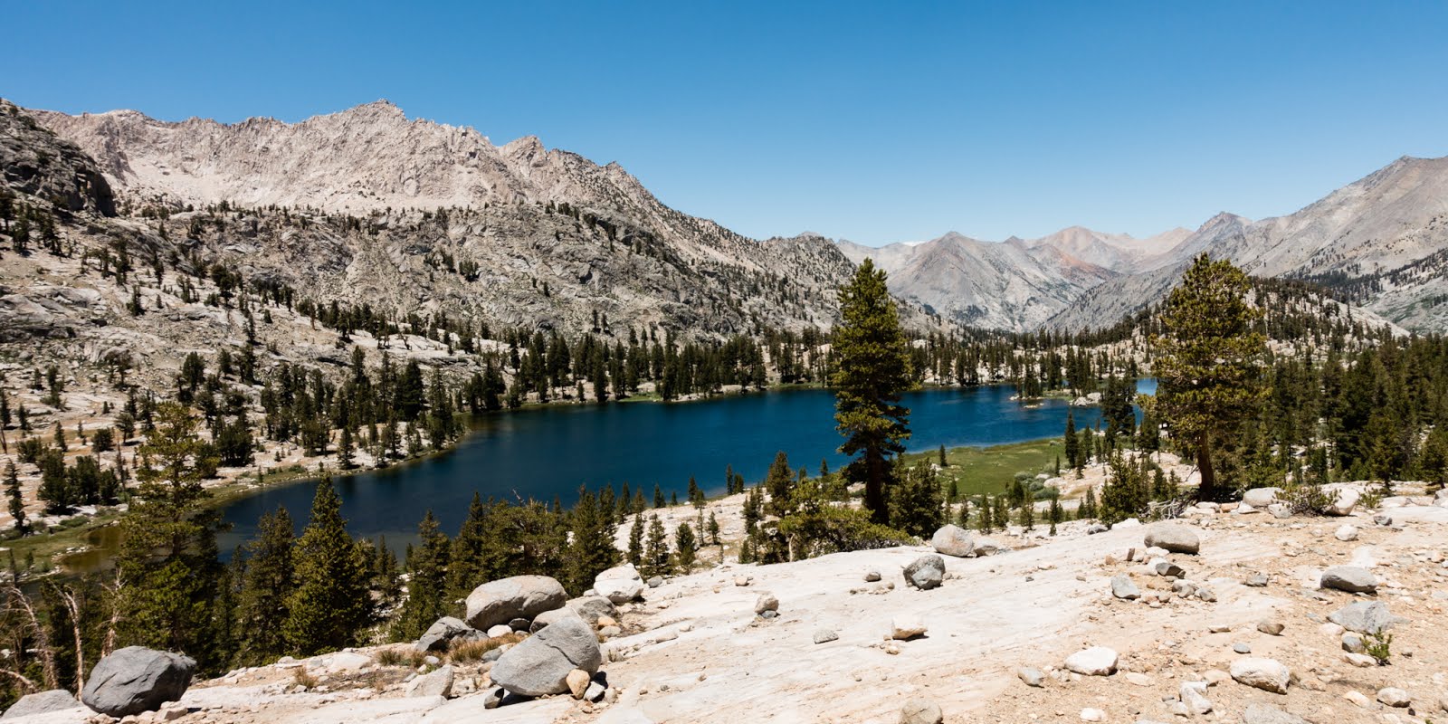
Looking South not too far from Glen Pass. The trail got rockier higher up, and I hiked the last couple of thousand feet to Glen Pass. It was about 11 am when I crested over Glen Pass at 12k ft, and it was a real treat because of the great views of Rae Lakes and the numerous tarns below the pass to the North. Part of the fun of running this loop was meeting and talking to all the backpackers that are hiking the Rae Lakes Loop and JMT. Among the many group I met, I chatted with a professor that my wife had taken classes from in college, a couple taking their time through hiking the JMT in 40 days, solo hikers, big parties, but all were having a blast being in a beautiful area. |
I also met two San Diego backpackers hiking the loop while I was going up to Glen Pass and they were descending and heading out to Road’s End that day. We would later cross paths again when we both reached the cars at the same time.
At Glen Pass, I met a JMT through hiker and we both exchanged photos before I started down.
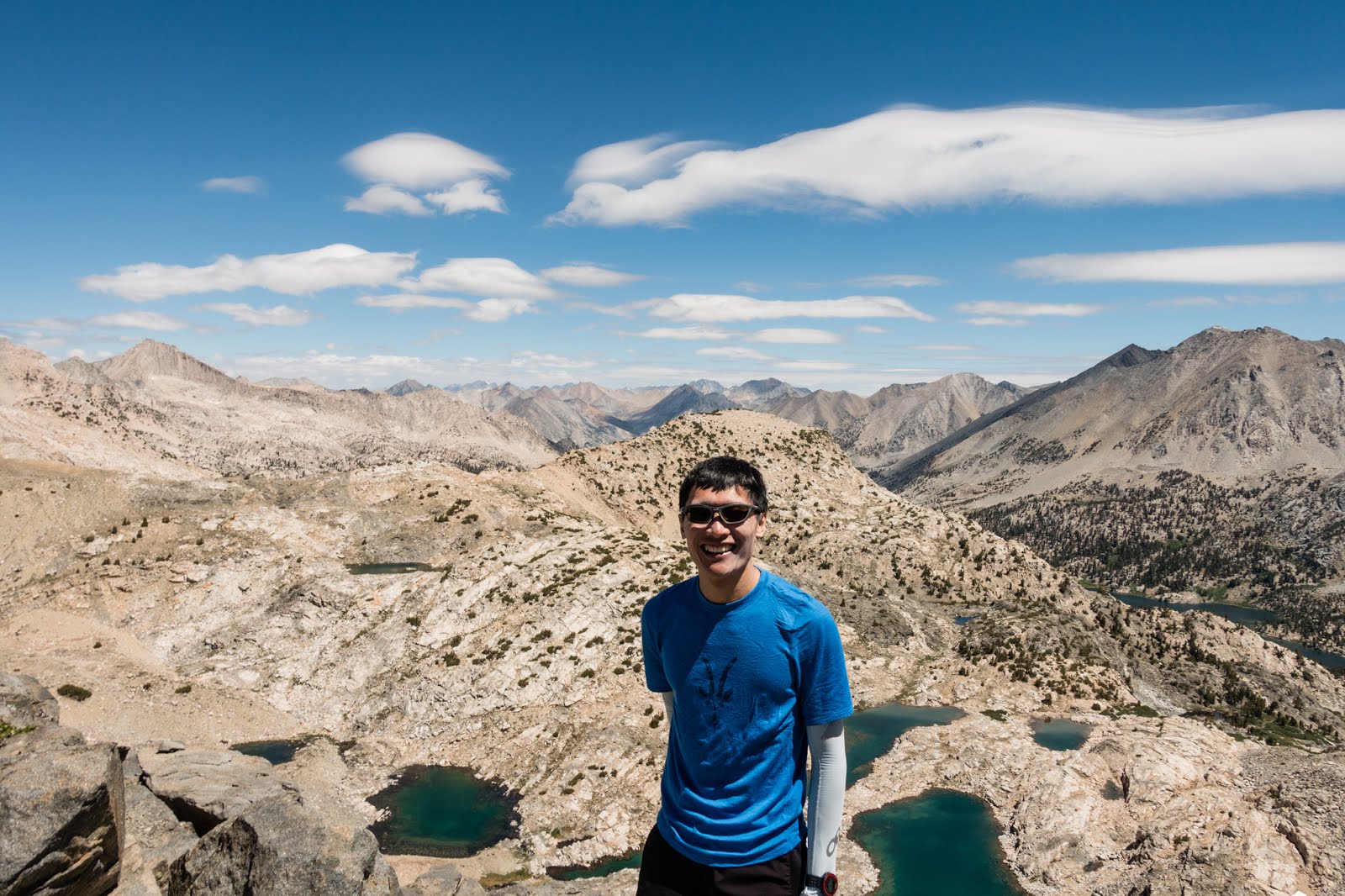
Obligatory photo at Glen Pass.
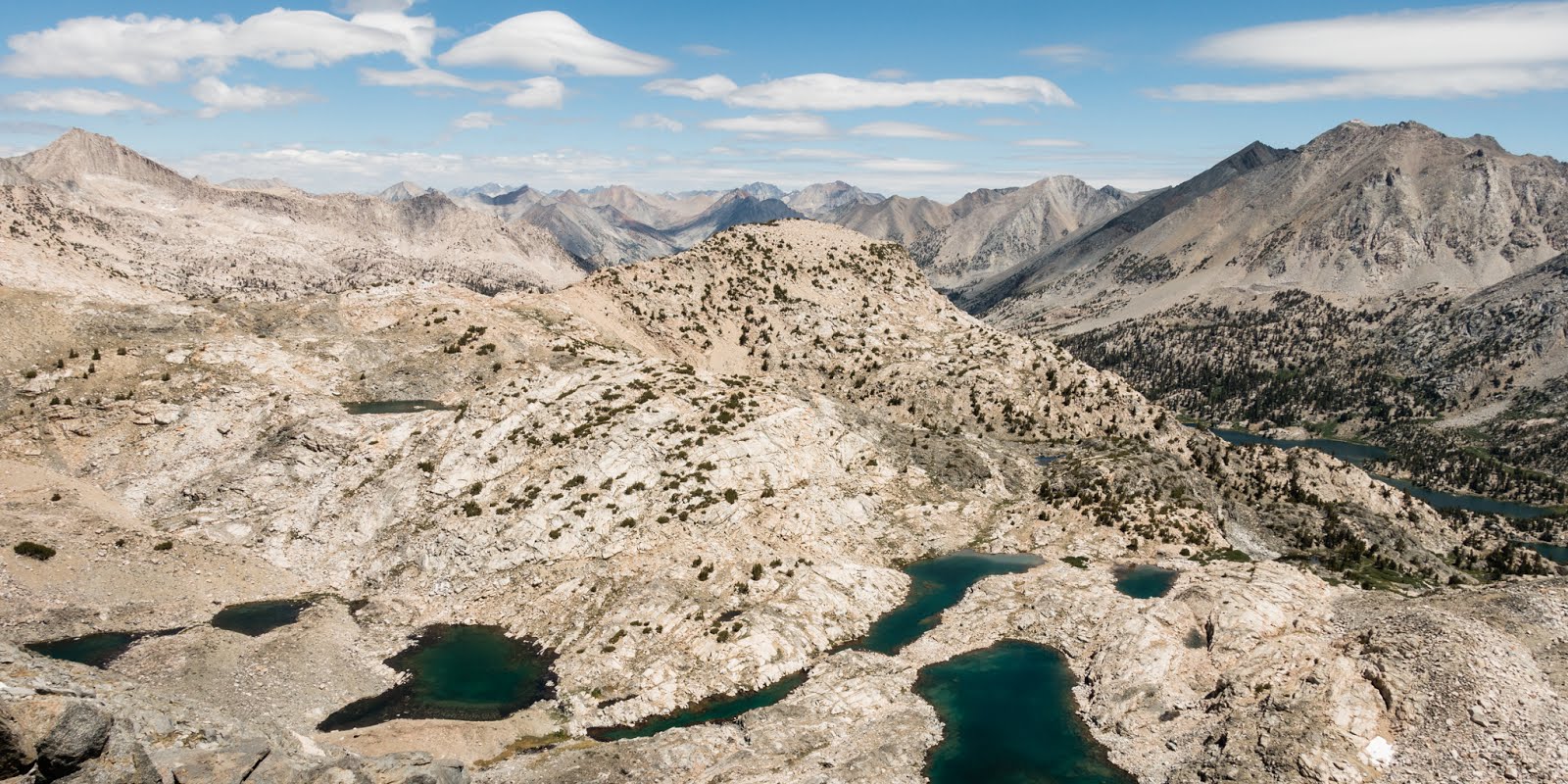
After descending Glen Pass, the JMT winds its way around some really beautiful alpine lakes and that section of the trail from Glen Pass to the south fork of Wood’s Creek was the highlight of the run.
Beautiful Arrowhead Lake right next to the JMT.
I’d been eating and drinking well throughout the day and as the trail descended below 9k ft in altitude, I felt stronger even though I’d been moving for quite a few hours by this time.
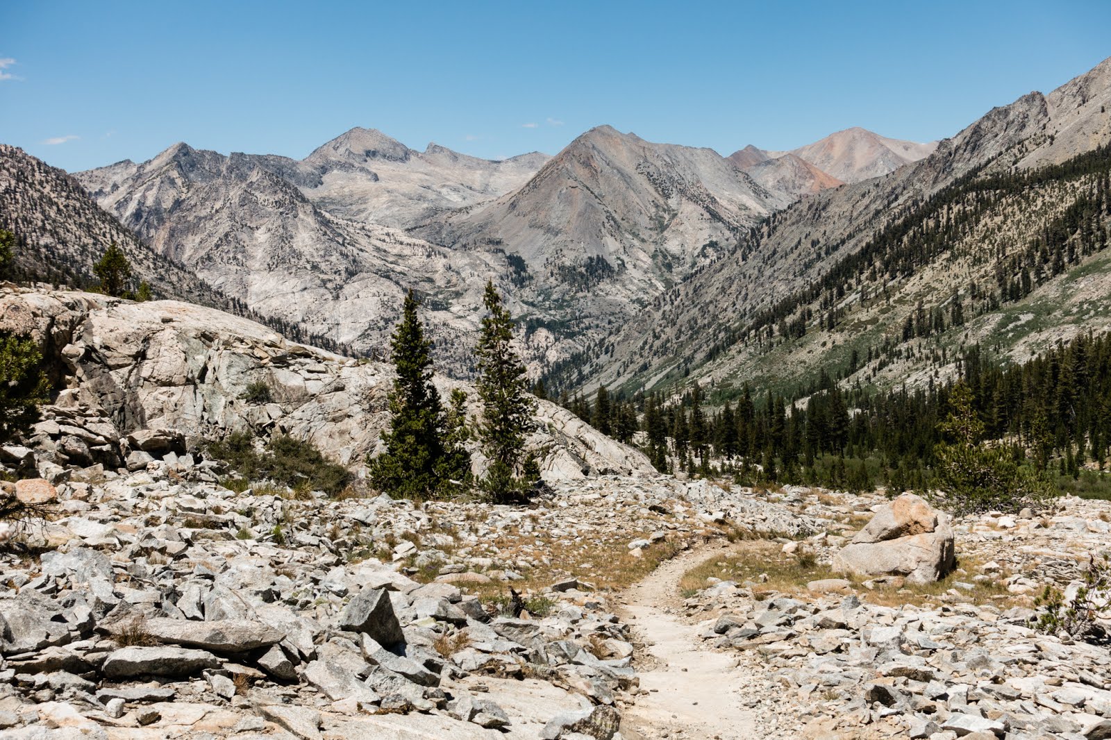
Last few miles downhill to Wood’s Creek along the JMT.
The rest of the run after the junction of Wood’s Creek was quite uneventful since I’d descended into the woods for most of the run and didn’t have much of a view. Castle Domes looked like it would be really fun to climb there if not for the 16 mile approach each way.
I suffered some slight ankle aches about 10 miles from the end of the trail because I’d foolishly laced my shoes too tight after my last water stop but I promptly stopped and loosened them when I figured out what the problem was.
I got back to my car around 7 pm, shared some drinks in my cooler with the two San Diego backpackers that I’d met a few miles below Glen Pass (we’d arrived back at the cars around the same time), changed into my flip flops and then drove 5 hours to reach home just after midnight.
While driving, I was puzzled that I felt so fresh and alert after a long day until I realised that I’d consumed the equivalent of 6-8 cups of coffee through my caffeinated gels that day! In fact, I had a hard time falling asleep that night after I’d reached home.
Epilogue
Snake sightings: 1 Bear sightings: 0
I thought I’d see a lot more wildlife because the people I met along the trail regaled me with stories of bear and snake sightings, so much so that I never kept my poles throughout the run, and instead kept them at the ready to fend off snakes and bears.
This run turned out to be significantly easier than the Grand Canyon despite the altitude, probably because it wasn’t as hot and I managed my nutrition better through the drink mixes.
Random tips
Spare socks. I enjoyed putting on a fresh pair of socks around mile 27-28, which is around the same time I changed socks at the Grand Canyon.
Check your shoes before you leave on a trip. As I was putting on my shoes at the trailhead, I noticed new large holes on in the uppers of both shoes next to my big toes! I’d also neglected to bring duct tape that could help patch them.
Maybe do squats. Oddly my quads didn’t get hit by delayed onset muscle soreness (doms) this time despite not doing squats. I later read on the internet that adaptation to doms lasts for months after the first training instance. I could jump right back into my regular running schedule by Wednesday the week after.