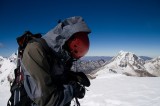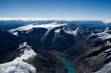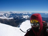
Tocllaraju (6032 m / 19,790 ft) - Northwest Ridge
The weather had gotten a lot better over the past few days since returning from the Huayhuash; Jared had also enjoyed not so great weather on Pisco and Yanapaccha. We had originally planned for a rest day after Ishinca. Fearing that the weather would turn, we instead skipped the rest day and spent the afternoon of the 28th (after returning from Ishinca) packing to move up to Tocllaraju moraine camp (5000 m) the following morning. I'd brought a 47 L pack to Peru, figuring that I should optimize for the majority of my trip when I only needed a smaller pack. Packing for Tocllaraju was when I realised that perhaps I should have optimized for the time when I needed the most space, which was the move up to moraine camp. After much grunting and strapping stuff to the outside, I managed to squeeze everything into my pack, but with all the technical gear, it weighed 50 lbs or so. Even worse was the poor weight distribution because I had to strap lots of stuff on the outside; I would later come to regret this while hiking over talus on the way to moraine camp.
We heard from a couple of guides about the strong winds on Tocllaraju, so strong that people were forced to turn back because they couldn't proceed past the ridge. We saw evidence of the winds the morning we left by the billowing clouds of spindrift being blown off the top 4 or 500 meters of Tocllaraju. Things weren't looking good at this point and we began to think that our summit chances were slim. Also weighing on my mind were that neither Jared nor I had ever ice climbed (the last two pitches of 70 m to the summit are a 55 degree ice slope rated D in Brad Johnson's guidebook) and that one of the twin ropes was cut by Jared and Chuck on Yanapaccha, leaving us with a 60 m and a 35 m pair of twins, which might not be enough to rap off comfortably. In addition, on the hike in to the Ishinca base camp, some climbers told us that a roped team broke through the snow bridge across the bergshrund the day before and had to be rescued out; as a result, we weren't sure if there was still a way across the bergshrund that was within our abilities.
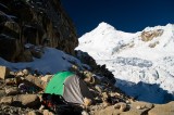
We left for moraine camp at about 11 am on the 29th after a massive breakfast of pancakes and tuna salad, reaching moraine camp around 1 in the afternoon. I suffered my way up the steep slope and then stumbled my way over the talus with an unstable pack. Staggering up to moraine camp over talus with a pack that was around 40% of my bodyweight was certainly the crux of the climb for me.
On the way up, we talked to two descending climbers, one had solo-ed the west face and the other had solo-ed the normal route, but both told us of the strong winds they encountered. We now at least knew there was an accessible way across the bergshrund. The guy who solo-ed the west face had camped around 5300 m on the glacier and while he was out climbing, his bivy sack, sleeping bag, stove, and other gear was blown away despite anchoring it down with a gallon or two of water because of the winds. We promised to look out for his gear but we privately thought that he'd never see it again. At moraine camp, we also met three Spanish climbers who had turned back from the summit because of the high winds. Melting snow for water took about 15 minutes per liter on my Primus white gas stove and we retired to bed at around 6, aiming for a 2 am wake up time. After getting up at 215 am, we got dressed, choking down 2 gels, put on boots, crampons, roped up; we only stepped onto the glacier at 340 am.
It was a full moon, bright enough that we didn't need headlamps. Moving on a glacier at 5000 m in the full moon surrounded by beautiful mountains glimmering in the moonlight was one of the best experiences I've ever had while climbing. It was too cold, unfortunately, for me to stop for night photos so I tried to take a mental picture of the scene.
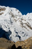
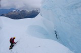
The 20 meter slope heading up to the bergshrund was steep snow/ice, about 50 degrees, followed by a short 10 meter traverse along the lower lip of the bergshrund before crossing two snow bridges. The first snow bridge was the sketchiest snow bridge I've ever had to cross; it was thin, barely 50 centimeters and there holes in it where someone's legs had broken through. Four quick steps and we were across. Then there was another 20 meter traverse on a 45 degree slope on the upper lip of the bergshrund before gentler terrain. Gaining the ridge required ascending a short section of 45 degree slopes, and that was when we started to feel the wind gusting across the ridge.
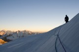
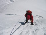
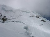
The climb until the final 70 meters of ice was easy cramponing up wind consolidated slopes with a constant wind of 20-30 mph and occasional gusts of maybe 50-60 mph. Both Jared and I stumbled more than once when caught by a sudden gust; being lighter, I was also driven to my knees on a few occasions. The last two ice pitches were much easier than expected, mostly thanks to the hordes that climbed Tocllaraju before us. The slope was indeed 55 degrees of hard snow/ice but there were pretty large bucket steps kicked in for both pitches; definitely not a D rated climb. Jared led the first 45 m pitch to the first set of rap anchors (2 equalized pickets) with 10 meters of simul-climbing since our ropes weren't long enough. I then led past him 25 meters to the second set of rap anchors and belayed him up. We brought 4 pickets as protection for this section but ended up placing only one picket in the first pitch just before we started simul-climbing.
From the top rap anchors, it was an easy 5 minute walk to the summit where we spent only a few minutes because it was windy and cold, and we could see clouds moving in. On the way down, our ropes were just long enough to do the last 45 m rappel; to save time, I rapped on a single strand of 7.7 mm, which wasn't fun, and Jared went last, passing the knot.
The way down was unexciting except when we had to cross the bergshrund again, which was scarier than going up because we could now see the huge bergshrund more clearly. Jared also found the bivy sack and other gear of the guy who lost his stuff. He spotted it sitting on a snow bridge in a crevasse, about half a mile away from where the guy had camped. I belayed him while he leaned over and fished it out with his tools. Back in Huaraz, the guy bought us a lot of beer when he got his gear back.
Tocllaraju is the best alpine climb I've done so far, very moderate but with short technical sections so that it's not just a walkup. I was exhausted after 2 weeks in the Huayhuash and a week in the Ishinca valley so I headed back to the US on the 3rd of July while Jared, Chuck, and Darren (they'd met Darren on Pisco) went on to climb Chopicalqui before returning home.


