Up one level Peru - Cordillera Huayhuash and Blanca, 11 June to 3 July 2007 » Cordillera Huayhuash Circuit - Day 1 → 2

Cordillera Huayhuash Circuit - Day 1 → 2

We spent 12 days hiking in the Cordillera Huayhuash, including two rest days when we went on side trips. The first 9 days of our circuit around the Cordillera Huayhuash was incredibly spectacular. I thought the Huayhuash circuit was certainly more scenic than the Torres del Paine circuit in Patagonia, and the weather was a lot better too.

Day 1 - Llamac (3300 m) → Laguna Jahuacocha (4070 m) crossing Macrash Punta (4272 m). We left Huaraz at 4 am and got to Llamac around 9 am. After having breakfast and loading up the mules, we left Llamac at 1030 am. Crossing the Macrash Punta gave the first spectacular view of the Huayhuash mountains. We spent an hour having lunch and then headed down to our first camp at Jahuacocha, arriving around 4 pm. Jahuacocha has really nice views but it is also heavily impacted by humans. There were half buried toilet holes all over the place and it was also crowded with 4 or 5 other groups. We were planning on spending our last night in the Huayhuash there but we changed our plans to avoid spending another night at Jahuacocha.

Day 2 - Laguna Jahuacocha (4070 m) → Rondoy (4050 m) crossing Sambuya Punta (4750 m) and Rondoy Punta (4735 m). We crossed two high passes in succession on the second day and were treated with more spectacular views of the Huayhuash range. Renting a horse turned out to be a good idea on the trip because there was invariably someone feeling poor every day. Zac figured out that we weren't big fans of camping in crowded campsites and suggested a small change to the standard Huayhuash circuit itinerary by camping at Rondoy instead of Matacancha or Quartelhuain. To make up the time the next day, we would cross Paria Punta instead of the standard Cacanan Punta.

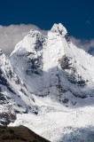
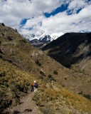
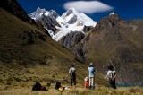
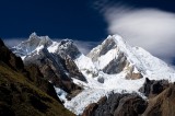
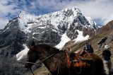
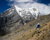
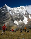
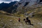
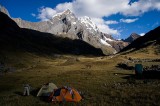
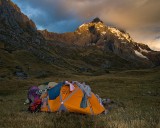
_mg_1240 View of the Huayhuash range from Macrash Punta (4274 m). From left, Rondoy (5870 m), Jirishanca (6094 m), Yerupaja Chico (6089 m), El Toro (5965 m), Yerupaja (6617 m). In the far right behind Yerupaja is Siula Grande (6344 m). _mg_1245 Jirishanca (6094 m). _mg_1248 From left, Rondoy (5870 m), Jirishanca (6094 m), Yerupaja Chico (6089 m), El Toro (5965 m). _mg_1260 Our horse at Macrash Punta (4272 m). _mg_1282 Serene, Emily, and Zac hiking down the valley from Macrash Punta to Laguna Jahuacocha. _mg_1284 Serene, Ray, and Emily hiking past some farms along the Rio Jahuacocha, about half an hour from Laguna Jahuacocha. _mg_1307 Jirishanca Norte (5989 m) , Jirishanca (6094 m), Yerupaja Chico (6089 m), El Toro (5965 m), and Yerupaja (6617 m) overlooking glacier TAM. _mg_1315 On the way up to Sambuya Punta (4750 m), Ray, Serene, Emily, and Zac checking out the odd lenticular like cloud over Yerupaja. In the bottom right is Laguna Solteracocha. _mg_1319 Yerupaja Chico (6089 m), El Toro (5965 m), and Yerupaja (6617 m) from halfway up to Sambuya Punta (4750 m). _mg_1324 Fernando and Juan-Carlos with our mule on the way up to Sambuya Punta. _mg_1340 Our horse at Rondoy Punta (4735 m). Ninashanca (5607 m) left and Rondoy (5870 m) right. _mg_1347 Serene hiking down from Rondoy Punta (4735 m). Ninashanca (5607 m) left and Rondoy (5870 m) right. _mg_1359 Eu-Jin running towards lunch! From left,  Zac, Emily, Ray, and Serene. Ninashanca (5607 m) left and Rondoy (5870 m) right. _mg_1366 Zac and Serene heading towards Rondoy. _mg_1374 Emily, Serene, and Zac heading towards Rondoy. Cerros Paria range on the right. _mg_1383 Emily, Serene, and Zac heading towards Rondoy. Cerros Paria range in the foreground. _mg_1388 Our campsite at Rondoy (4050 m). Ninashanca (5607 m) left and Rondoy (5870 m) right. img_0354 Serene organizing the tent in Rondoy. Eu-Jin's laundry is hanging on the tent. Taken by Raymond Woo. _mg_1390 Alpenglow on Ninashanca (5607 m).